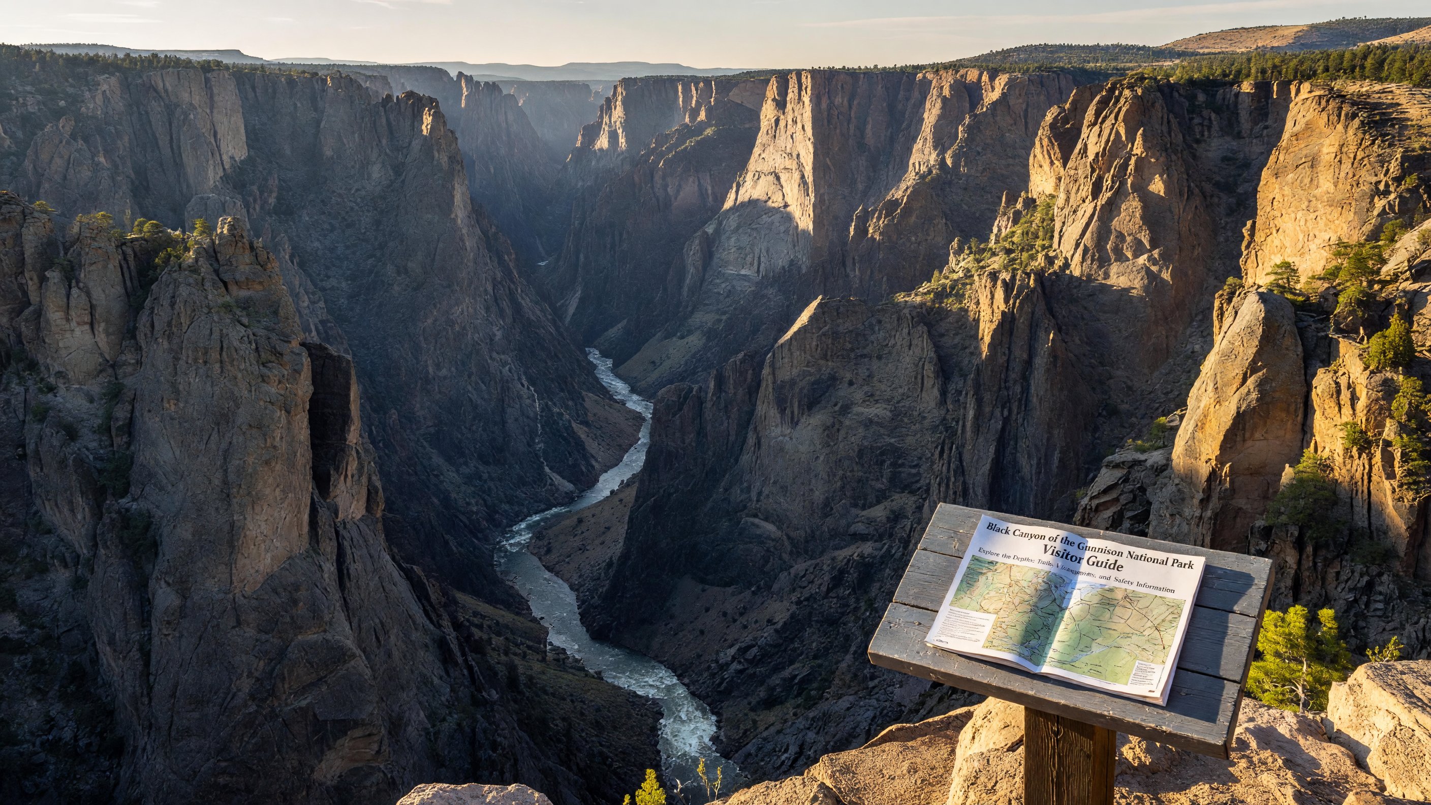
Some canyons are wide. Some are deep. Black Canyon of the Gunnison in western Colorado is both, and the combination is disorienting in a way that photographs rarely capture. At its narrowest point, the canyon is only 40 feet across at the river — yet the walls rise 2,722 feet from the Gunnison River to the rim. The ancient Precambrian rock, which took roughly 2 million years to be incised by the river to its current depth, is the darkest in Colorado — schist and gneiss streaked with lighter intrusions of pegmatite that create the swirling pale patterns on the canyon faces. The overall effect is one of vertical drama unlike anything else in the national park system.
The Painted Wall: Colorado’s Tallest Cliff
The Painted Wall is the first thing you’ll want to see, and you can reach it by car. Located on the South Rim Drive at a designated pull-out, the Painted Wall is a vertical cliff face 2,250 feet tall — the tallest cliff in Colorado — streaked with pale pink and white pegmatite dikes that give the wall its name. The “paint” patterns shift as the light changes throughout the day, and the best viewing conditions are generally in the morning before the opposite rim casts shadow on the face. Rock climbers from around the world make pilgrimages to the Painted Wall, and if you watch long enough from the overlook you may catch a tiny speck of movement on the face — a climber working one of the wall’s legendary multi-day routes.
South Rim: The Accessible Overlooks
The South Rim, open year-round (weather permitting), is where most visitors spend their time. South Rim Drive runs about 6 miles from the visitor center to High Point, with more than a dozen overlooks along the way. Each one provides a slightly different angle on the canyon and river, and each surprises you differently with the scale of what you’re looking at. Gunnison Point, directly behind the visitor center, is the park’s most-visited overlook and offers the broadest view of the canyon’s upper reach. Cross Fissures View and Devil’s Lookout further along the drive put you on narrow promontories that jut over the abyss — standing at the edge and looking straight down is an experience that makes many visitors instinctively step back. No railing, no guardrail — just the rim and what’s below it.
South Rim Trails: Walking the Edge
Several hiking trails depart from the South Rim and offer perspectives the car overlooks can’t provide. The Rim Rock Nature Trail (1 mile loop) is easy and flat, circling through scrub oak and sage near the campground. The Oak Flat Loop (2 miles round-trip) dips below the rim into the upper canyon slopes, giving you a sense of the terrain between the rim and the river far below. The Warner Point Nature Trail (1.5 miles round-trip) at the end of South Rim Drive reaches a secluded overlook with views both down the canyon and across to the distant San Juan Mountains — excellent at sunset. These trails are genuinely accessible without technical skill, though the terrain is rugged and the exposure real.
Inner Canyon Access: Not for the Unprepared
Getting to the river at the bottom of Black Canyon is a very different matter from standing at the rim. Three inner canyon routes on the South Rim — the Gunnison Route, the Warner Route, and the Tomichi Route — descend to the river through unstable talus, dense brush, and unmarked terrain at grades that require the use of hands and feet. These are not maintained trails; they are routes, marked only by occasional chains anchored into the rock on the steepest sections. Inner canyon access requires a free permit obtained from the visitor center, and rangers will ask about your experience level and gear. The descent to the river takes most fit hikers 45 minutes to an hour; the return trip up takes considerably longer. The Gunnison River at the bottom is a world-class whitewater kayaking and fishing destination, with gold medal-designated trout water in the upper stretch of the canyon.
North Rim: Quiet and Remote
The North Rim offers a completely different experience from the crowded South Rim. It’s only 12 miles from south to north across the canyon by air, but roughly 80 miles by road, and the unpaved North Rim Road is closed in winter. The North Rim Campground is small and serene, and the overlooks along North Rim Road show the canyon from angles not visible from the south side. If you value solitude and don’t mind a longer drive, the North Rim delivers the same geological spectacle with a fraction of the visitors. Rangers are not always present on the North Rim; come prepared with everything you need.
Planning Your Visit
Black Canyon is about 15 miles from Montrose, Colorado, and about 65 miles from Grand Junction. It pairs naturally with a broader western Colorado itinerary that might include the Colorado National Monument, Curecanti National Recreation Area (which contains Blue Mesa Reservoir, the upper reservoir on the Gunnison River), or Florissant Fossil Beds National Monument further east. For planning across Colorado’s remarkable concentration of national parks, see our Planning Tips section. The official Black Canyon of the Gunnison NP site on nps.gov has current road conditions, permit information, and ranger program schedules.
Frequently Asked Questions
Why is it called Black Canyon? The name comes from the canyon’s dark Precambrian walls that receive very little direct sunlight. Some sections get less than 30 minutes of sun per day due to the extreme depth and narrow width.
Can you hike to the bottom? Yes, but it requires a free inner canyon permit and involves steep unmaintained routes with chains on the hardest sections. For experienced hikers only.
How tall is the Painted Wall? 2,250 feet — the tallest cliff in Colorado. Visible from a designated pull-out on South Rim Drive.
Is Black Canyon open year-round? The South Rim is open year-round (weather permitting). The North Rim Road is closed from late autumn through late spring.