I have driven the entrance road into Arches more times than I can reliably count, and it still does something to me. The moment the Entrada Sandstone formations come into full view above the desert flats — fins and balanced rocks and improbable windows carved by two hundred million years of geology doing its patient work — I always find myself slowing down more than traffic requires. This park earns that response.
Arches National Park sits on a high desert plateau above Moab in southeastern Utah, covering roughly 76,519 acres of the Colorado Plateau. Within that area, more than 2,000 natural sandstone arches have been formally documented — the highest confirmed concentration of natural arches on Earth. They range from tight openings barely wide enough to crawl through to Landscape Arch, which spans approximately 290 to 306 feet across (measurements vary by methodology) and is recognized as one of the longest natural arches anywhere in the world. The park’s geology begins with a massive underground salt bed deposited during the Paradox Formation some 300 million years ago. As the salt deformed under the weight of overlying sediment, it buckled the surface into parallel ridges — the sandstone fins that erosion then worked on for millions of years, hollowing out the weaker layers to form windows and eventually arches.
Delicate Arch — standing on its slickrock bowl with the La Sal Mountains as backdrop — has become one of the most reproduced images in American landscape photography, and it graces the Utah license plate. Seeing it in person is genuinely different from seeing any photograph of it. The scale is a surprise, and the setting — the canyon dropping away below the bowl’s far rim — adds a dimension that no photo I’ve seen manages to fully convey.
The Timed-Entry Experiment: What Happened and Where It Stands in 2026
If you’ve been following Arches over the past couple of years, you know that the park ran a timed-entry reservation pilot during the 2024 and 2025 seasons. The program required vehicles entering between 7:00 a.m. and 4:00 p.m. from April 1 through October 31 to hold a $2 reservation made through Recreation.gov. Reservations were released in monthly batches and routinely sold out within minutes of each release window.
The pilot was a direct response to the park’s overcrowding problem. Arches sees roughly 1.8 million visitors per year through a single entrance road, and peak-season gridlock had reached the point where the park was turning vehicles away at the gate and the parking areas at major trailheads were full by mid-morning. The reservation system was designed to smooth arrival patterns across the day and cap the number of vehicles during the busiest hours.
For 2026, the NPS has confirmed that advanced timed-entry reservations will not be required at Arches. Visitors may enter the park at any time during normal operating hours without a reservation. The timed-entry pilot has concluded for now, though the agency may revisit the approach in future seasons depending on visitation trends.
What this means practically: the main congestion levers you have in 2026 are arrival time and season selection. Arriving before 8:00 a.m. — or after 3:00 p.m. — on a spring weekend still dramatically changes the experience versus midday. The trailhead lots at Delicate Arch and Devils Garden fill by 9:00 a.m. on peak days even without a reservation gate. Arrive early or plan late afternoon arrivals, bring a full park day, and you’ll have what the reservation system was trying to manufacture.
Note: reservations are still required for Devils Garden Campground (opens six months in advance, books almost instantly for spring and fall weekends) and for Fiery Furnace ranger-led tours and independent hiking permits. Those systems have not changed.
Delicate Arch: The Hike Worth Building Your Day Around
The Delicate Arch Trail begins at the Wolfe Ranch parking area — a small historic log cabin marks the trailhead — and covers 3 miles round trip with 480 feet of elevation gain. On paper that sounds moderate. In practice, the entire route is exposed slickrock with virtually no shade, and the effort required scales directly with temperature and sun intensity. I’ve done this hike in March and in July and they are barely the same experience.
The trail follows the slickrock surface marked by cairns, passes a panel of Ute rock art near the beginning (worth stopping to look at — it’s easy to miss), and then climbs a long series of open sandstone domes. In the final approach, the route narrows to a ledge across a sandstone face above a canyon drop. It’s the only moment of real exposure on the hike, and while it’s not technical, it gives some people pause. After that ledge, you step around a final curve and Delicate Arch appears.
The arch stands 46 feet high and 32 feet wide at the base. Those numbers mean nothing until you’re standing ten feet from it. Allow two to three hours for the round trip at a comfortable pace. Carry at least two liters of water per person — three liters in warm weather. Start before 9:00 a.m. from April through September; before 8:00 a.m. in June, July, and August if you want any reasonable experience in the heat.
For photography: Delicate Arch is at its best in the two hours before sunset, when the west-facing arch catches warm light against the red fins and the La Sal Mountains recede into blue shadow behind it. The bowl fills up with photographers in that window — arrive early enough to set up before the crowd. I’ve had the best results with a 24-70mm range for full arch and environment, and a longer lens (100-200mm) compressed against the mountains for a more dramatic background relationship. Tripods are useful for the lower light toward the end of the session.
Delicate Arch Viewpoint: A separate short trail from a lower parking area on the main park road reaches a ridge with a distant but clear view of the arch from across the canyon. It’s roughly half a mile round trip, mostly flat, and requires no particular physical ability. The view is genuinely distant — you’ll want binoculars or a telephoto lens to see detail — but it’s a worthwhile option for visitors who cannot manage the full hike or who want a different compositional angle.
The Windows Section: Maximum Arches, Minimum Miles
The Windows Section, accessed via a side road approximately eight miles from the visitor center, delivers the best arch-per-mile ratio in the park. The North and South Windows — two adjacent openings in the same rock fin — are visible from a short trail (about one mile for the loop) that also passes Turret Arch, a formation with distinctive secondary openings. The three arches together create enough variation for a full photography session without covering significant distance.
Double Arch sits in its own parking area a short distance from the Windows lot. The approach trail is about 0.9 miles round trip, mostly flat, and the formation — two arches sharing a single rock column — is enormous up close. The larger opening spans 148 feet; the second spans 112 feet. Standing inside the double frame and looking out is one of the park’s better experiential moments.
For photography: The Windows Section faces predominantly east and northeast, which means morning light is the opportunity here. I’ve shot the North and South Windows in the first hour after sunrise when the openings frame a vivid blue sky and the rock faces are in warm directional light. Midday flattens everything. Evening works for Turret Arch from certain angles, but morning is the primary window (no pun intended) for this section.
This is also the best cluster for visitors with limited time or mobility concerns. The paved portions of the Windows area are short enough for most visitors, and the Double Arch trail is mostly compacted gravel and sandy rock with no significant grade change for most of its length.
Landscape Arch and the Devils Garden Trail
The park road ends at the Devils Garden Trailhead, 18 miles from the visitor center, and this is where serious hikers should spend their day. The trail begins with a well-maintained path that reaches Landscape Arch in about 0.9 miles from the trailhead — making the Landscape Arch out-and-back roughly 1.8 miles total.
Landscape Arch is extraordinary and unsettling in equal measure. The span — approximately 290 feet by NPS measurement, with some sources citing up to 306 feet depending on methodology — is so thin in its midsection that it looks wrong, like the arch that should have collapsed. It has been collapsing, slowly. In 1991 a significant rock slab fell from the underside of the arch, and hikers are no longer permitted to walk beneath it. The closure is enforced with rope barriers and signs. Photograph it from the established viewpoint and respect the boundary — the science on arch stability suggests this one’s timeline is uncertain.
Beyond Landscape Arch, the trail continues on a primitive route across slickrock to additional arches including Double O Arch and the aptly named Dark Angel formation. The full Devils Garden loop — taking in all the named arches on the primitive route — covers approximately 7.2 miles and involves some route-finding, cairn-following, and one or two exposed scrambles. I’d classify it as moderate-strenuous for the full loop. Plan four to five hours and bring more water than you think you need; the slickrock radiates heat even when the air feels cool.
For photography: Landscape Arch’s orientation — roughly east-facing in a shaded canyon — means it receives filtered light for most of the day and rarely gets the kind of dramatic direct sun that makes for high-contrast shots. Overcast days are actually excellent here; the soft light reveals the arch’s texture without harsh shadows. I’ve had good results at midday in overcast conditions when the canyon walls reflect soft, even light across the span.
Fiery Furnace: The Permit-Only Labyrinth
The Fiery Furnace is a compact maze of sandstone fins, slots, and narrows in the park’s central section — an entirely different experience from the open desert of the main road. Access is restricted because the interior contains highly fragile cryptobiotic soil crusts (the dark, lumpy biological communities that take decades to recover from a single footstep) and no established trail markings.
There are two ways in. The first is a ranger-led tour: book through Recreation.gov, pay the tour fee (typically around $16 for adults, $8 for children), and spend two to three hours with a ranger who knows the maze’s geography and interprets its ecology. These tours book out weeks in advance and I consider them worth the planning effort. The second is an independent hiking permit, also issued through Recreation.gov, which requires completing a mandatory orientation video at the visitor center before entering. The permit is $10 per person. The orientation isn’t optional and the permit isn’t a formality — the maze is genuinely disorienting and the soil it contains is genuinely fragile.
From a photography standpoint: the narrow slots of the Fiery Furnace produce excellent light in the mid-morning when sun angles down into the gaps between fins. Bring a wide-angle lens (I shoot 16-24mm in here) and a camera that handles ISO 1600 comfortably, because you’ll be moving between very bright open areas and very dark shadow slots within steps of each other.
A Note on Mesa Arch — and Why It’s Not Here
Mesa Arch is one of the most commonly cited sunrise photography spots in the canyon country region, and I want to address it directly: Mesa Arch is not in Arches National Park. It’s located in Canyonlands National Park, in the Island in the Sky district, about 32 miles from the Arches entrance. The two parks are distinct units of the National Park System, each requiring separate admission.
That said, if you’re making a Moab base-camp trip — and you should — combining both parks is straightforward. Island in the Sky is the closest Canyonlands district to Moab (about 35 miles from downtown), and Mesa Arch is a 0.6-mile flat loop near the district visitor center. Sunrise at Mesa Arch — when the rising sun illuminates the canyon below through the arch’s frame — is among the most photographed natural moments in the American Southwest. Plan to arrive 30–45 minutes before sunrise and expect company; this is a popular spot. For full arrival timing, focal length recommendations, and light direction notes across twelve Western parks, see the Best Sunrise Photography Spots in Western US National Parks.
Moab and Practical Logistics
Moab sits approximately 5 miles south of the Arches entrance on US-191, and it functions as the gateway community for both Arches and Canyonlands. The town has grown substantially over the past decade in response to visitation pressure, and it now offers a full range of lodging (from budget motels to boutique hotels to vacation rentals), dining, grocery, and outdoor outfitter services. Most outfitters on Main Street can rent bikes, jeeps, and camping gear, and several offer guided jeep tours, canyoneering, and river trips in the surrounding BLM land.
For Arches specifically: fill up on water in Moab. The visitor center has water, but trailhead facilities are minimal and the heat is serious. A 64-ounce capacity per person for half-day hikes; a full liter per hour per person in summer.
The park visitor center is about two miles past the entrance gate and worth 20 minutes to orient yourself, collect a paper map (the topography context is genuinely useful), and check for any closures or conditions. Rangers at the desk are consistently good at calibrating trail recommendations to your actual fitness level — ask them.
Seasonal Planning
Spring (March–May): The best overall season. Temperatures are moderate (50s–70s°F), desert wildflowers can be exceptional in April, and the light has that clear, low-angle quality that photographers chase. Crowds peak on spring break weekends; mid-week visits in March and early April are excellent.
Summer (June–August): Temperatures regularly exceed 100°F on the exposed rock. Afternoon thunderstorms are common and can be spectacular, but lightning is a real hazard on open slickrock. If you’re here in summer: start before 8:00 a.m., finish major hiking by noon, and plan to return in the late afternoon for photography light. Carry more water than the guide says.
Fall (September–October): A close second to spring. The crowds thin somewhat after Labor Day, temperatures become reasonable again (60s–80s°F), and the fall light is particularly good for red rock photography. September can still be very warm; October is often ideal.
Winter (November–February): The park is open year-round. Snow on the red rock is extraordinarily photogenic, and the crowds essentially vanish. The tradeoffs: snow and ice on slickrock create genuine hazard, some roads may be temporarily closed, and days are short. Microspikes are useful for winter hiking. The upside for photographers is hard to overstate — I’ve shot Delicate Arch in a light snowfall with almost no other visitors present, and those images are among my favorites from any park.
Accessibility
The park has limited but meaningful accessible options. The Park Avenue Viewpoint (near the entrance area) is a paved overlook with views of the distinctive sandstone fins that line the park’s first section. The Balanced Rock Trail is a short (0.3-mile) paved loop around the base of one of the park’s iconic balanced formations. The Windows Section viewpoints offer good arch views from short, compacted-surface approaches. The Delicate Arch Viewpoint lower trail is flat and mostly paved for its short distance.
The NPS accessibility page for Arches (nps.gov/arch) has current detail on surface conditions and facilities. I’d recommend calling the visitor center (435-719-2299) to confirm current accessibility conditions before planning a trip around specific accessible trails, as surfaces and facilities can change seasonally.
Frequently Asked Questions
Do I need a timed-entry reservation for Arches in 2026? No. The NPS has confirmed that timed-entry reservations are not required for Arches in 2026. You can enter the park at any time during operating hours without a reservation. Note that reservations remain required for Devils Garden Campground and Fiery Furnace permits.
How hard is the Delicate Arch hike? It’s rated moderate — 3 miles round trip, 480 feet of elevation gain, entirely on exposed slickrock with no shade. The difficulty scales sharply with temperature. On a cool spring morning it’s a thoroughly enjoyable two-hour hike. In July heat it’s a serious physical undertaking. There’s one short exposed ledge section that some visitors find uncomfortable; it’s not technical but it does require stepping across a narrow path above open air.
What is the best order to see the main attractions? If you have a full day, I’d suggest: Devils Garden (Landscape Arch + as much of the loop as you want) in the morning when the trailhead lot is emptier; Windows Section midday for its short distances; Delicate Arch in the late afternoon for sunset photography. This sequences the long hike when it’s coolest and puts the iconic photography moment at the right light.
When should I book Devils Garden Campground? Six months before your target date, the day reservations open on Recreation.gov. For spring and fall weekend dates, this is not an exaggeration — they sell out the same day. Set a calendar reminder for exactly six months out.
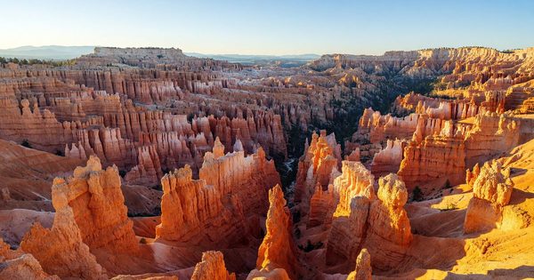
Is Arches worth visiting in combination with Canyonlands? Absolutely. Island in the Sky (the closest Canyonlands district) is 32 miles from Arches. A two-park itinerary with three to four days based in Moab is the standard Colorado Plateau trip. Mesa Arch sunrise at Canyonlands and Delicate Arch sunset at Arches are the two signature photography anchors for the trip. For a longer Utah circuit, Bryce Canyon National Park — about 250 miles west — adds hoodoo terrain, dark sky stargazing, and completely different geology to a multi-park itinerary. The full five-park Mighty 5 loop is covered in the Best Multi-Park Road Trip Routes in the American West guide, which includes stop-by-stop itineraries, drive times, and lodging logistics for Arches and Canyonlands as part of the Utah loop.
Resources
- Arches National Park — National Park Service — current alerts, conditions, road closures, fee information
- Recreation.gov — Arches — Devils Garden Campground reservations, Fiery Furnace permits
- National Parks Conservation Association — advocacy and policy context for Arches and the Colorado Plateau
- USGS Geology of Arches — background on Entrada Sandstone, salt dome formation, and arch geology
- Dead Horse Point State Park — Utah State Parks site for the nearby overlook (30 miles from Moab), which offers one of the best canyon views in the region from a short, accessible walk