The American West contains the densest concentration of major national parks on the continent, and the geography — mostly flat-to-rolling high desert connected by long, fast highways — is purpose-built for road trips. Five of the routes below have become genuine classics, repeated by hundreds of thousands of visitors per year. Each one earns that status for a reason: the parks cluster logically, the drive times between stops are honest (three to five hours, rarely more), and the photography windows tend to align with the best light at multiple stops on the same day.
What these routes rarely tell you upfront: they require more planning than they look like. Two of the five involve parks or monuments outside the NPS system where the America the Beautiful pass does not apply. Three of the five have active timed-entry or reservation systems in peak season. All of them will break your heart if you show up at the most iconic viewpoints at noon on a July Saturday and wonder why the light looks flat and the parking lot looks like a stadium.
I’ve driven versions of all five of these routes, and I’ve also driven them wrong — wrong season, wrong time of day, wrong vehicle for a particular road. The notes below reflect those mistakes as much as the successes.
Route 1: The Mighty 5 Utah Loop
Parks: Zion → Bryce Canyon → Capitol Reef → Arches → Canyonlands Duration: 7–10 days Distance: 600–650 miles (Las Vegas base) / 700 miles (Salt Lake City base) Best base airports: Las Vegas (LAS) or Salt Lake City (SLC) Pass math: $80 America the Beautiful covers all five NPS units (Zion: $35/vehicle, Bryce: $35, Capitol Reef: $20, Arches: $30, Canyonlands: $30). Break-even after two parks; at all five you save $70 over single-entry fees.
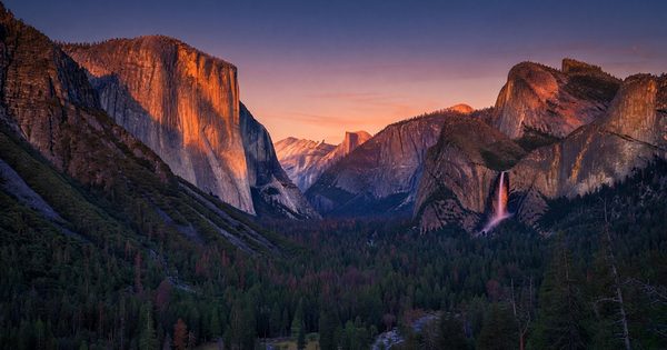
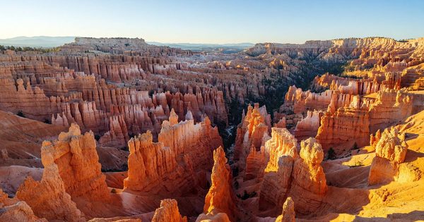
The Mighty 5 is Utah’s signature road trip, and it delivers five genuinely distinct park personalities in a loop that works logistically. Zion is canyon-bottom-up — you’re inside the walls. Bryce is rim-top-down — you look into a forest of red-orange hoodoos. Capitol Reef is empty, weird, and underappreciated. Arches is the postcard-shot park with the photographic spine. Canyonlands is the vast, uncrowded opposite of everything that surrounds it.
Stop-by-stop itinerary (Las Vegas start):
Days 1–2 — Zion National Park (3.5 hrs from Las Vegas via I-15) Check into Springdale or the Zion Lodge (National Park Service concessioner; book via recreation.gov). The Zion Lodge is the only in-park accommodation — historic cottages and motel rooms, booked solid in summer, available with lead time in shoulder season. Springdale, UT (just outside the south entrance) has a full range of gateway hotels and restaurants. The park shuttle system runs from Springdale to the Canyon Junction from spring through fall — private vehicles beyond the visitor center require a shuttle. Angel’s Landing now requires a permit via Recreation.gov lottery even for day hikers. Don’t skip the Narrows bottom-up route (weather-permitting; check the Virgin River flow reports). Photography priority: Canyon Junction Bridge at sunrise for soft light on the west wall.
Drive to Bryce: 86 miles / 1.5 hrs via UT-9 East and US-89 North.
Days 3–4 — Bryce Canyon National Park Lodge at The Lodge at Bryce Canyon (managed by Aramark; book well in advance for summer) or in Bryce, UT. The rim trail between Sunset and Sunrise Points is the most accessible walk in the park and delivers the most concentrated hoodoo views — do it at golden hour, not midday. Navajo Loop + Queens Garden combo trail (5.5 miles round trip) drops into the amphitheater and gets you inside the formations. Bryce’s high elevation (8,000 to 9,100 feet rim) means it’s significantly colder than Zion — pack layers even in summer. Photography priority: Sunset Point at sunset (obvious, for good reason) and Inspiration Point for a wider overlook at dawn.
Drive to Capitol Reef: 115 miles / 2.5 hrs via UT-12 East (one of the most scenic highway drives in the country — do not rush this stretch).
Days 5–6 — Capitol Reef National Park No in-park lodge — the Fruita Campground (first-come, first-served for most sites; a small number reservable via Recreation.gov) is the in-park option. Torrey, UT (11 miles west on UT-24) has inn and hotel options. Capitol Reef receives roughly one-third the visitors of Zion and Bryce, which makes it one of the best decisions you can make on this loop. The Scenic Drive (a toll road within the park — $10/vehicle, not covered by the America the Beautiful pass for this specific scenic drive segment, though park entry itself is covered) runs 8 miles into Capitol Gorge past petroglyphs and waterpockets. Notom-Bullfrog Road, a mostly-unpaved route along the Waterpocket Fold, requires a high-clearance vehicle in wet conditions — check the NPS Capitol Reef road conditions page (nps.gov/care) before attempting it in any season.
Vehicle note for Capitol Reef: The park’s paved main corridor is fine for any vehicle. The Cathedral Valley Loop (a remote northern section) requires high-clearance 4WD. Most visitors on this loop stay on the pavement — that’s entirely valid.
Drive to Moab (base for Arches and Canyonlands): 210 miles / 3.5 hrs via UT-24 East and US-191 South.
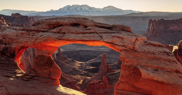
Days 7–9 — Arches National Park + Canyonlands National Park Base in Moab, UT (most visitors choose this; in-park lodging at Canyonlands doesn’t exist and Arches has only campgrounds). Moab has dozens of hotel and vacation rental options across all price ranges. Arches note: The park has operated a timed-entry pilot program in peak season — check current NPS Arches timed-entry status (nps.gov/arch) before your trip; requirements have shifted year to year. Photography priority for Arches: Delicate Arch at sunset (expect a 3-mile round trip hike with 480 feet of gain; arrive 2 hours before sunset), and Mesa Arch at Canyonlands at sunrise (a 10-minute flat walk from the trailhead; see the Western parks sunrise guide for approach timing).
Drive back to Las Vegas: 272 miles / 4 hrs via US-191 South and I-15 South. Or to Salt Lake City: 235 miles / 3.5 hrs via US-191 North and I-15 North.
Seasonal notes:
- Spring (mid-April to early June): Best overall window. Mild temps at canyon elevations, wildflower potential, light crowds before Memorial Day.
- Summer (June–August): Zion and Arches can be 95–105°F in canyon bottoms. Bryce is cooler (8,000 ft). Crowds peak in July. Timed-entry systems active.
- Fall (September–October): Excellent. Cottonwood color in canyon bottoms late October, cooling temps, reservations easier to get.
- Winter: Bryce in snow is extraordinary for photography. Zion’s Narrows is cold but doable with drysuits and dry pants. Capitol Reef and Arches are uncrowded and manageable in winter except during infrequent snow/ice closures.
Route 2: Pacific Northwest Big 3
Parks: Olympic → Mount Rainier → North Cascades Duration: 7–10 days Distance: 500–600 miles round trip from Seattle Best base airport: Seattle-Tacoma (SEA) Pass math: $80 America the Beautiful covers all three NPS units (Olympic: $35/vehicle, Mount Rainier: $35, North Cascades: $25). Break-even after two parks; third park adds $25 in savings.
The Pacific Northwest cluster is a trio of genuinely different park experiences within a relatively compact geography, all accessible from Seattle. Olympic is three ecosystems in one peninsula — temperate rainforest, glacier-capped peaks, and 73 miles of wild Pacific coast. Mount Rainier is a 14,411-foot active stratovolcano surrounded by subalpine meadows that explode with wildflower color in late July and August. North Cascades is the least-visited of the three and arguably the most dramatic — jagged alpine peaks with over 300 glaciers, almost no visitor services, and a sense of genuine wilderness that Rainier (with its extensive road system) doesn’t quite replicate.
Stop-by-stop itinerary:
Days 1–3 — Olympic National Park (3 hrs from Seattle via Bremerton ferry or via US-101 South and West) Olympic has no single entrance — it wraps around the Olympic Peninsula with multiple access points. The park has several in-park lodges: Kalaloch Lodge (ocean coast — book via the lodge directly), Sol Duc Hot Springs Resort (rainforest interior), and Lake Crescent Lodge. All three are operated by park concessioners under NPS contract. All three book up well in advance for summer; shoulder-season availability is reasonable. Plan 2–3 days to do justice to at least one rainforest valley (Hoh Rain Forest is the most accessible and most photographed — the Hall of Mosses is the first stop) and one coastal segment (Rialto Beach at sunset is worth the detour). Hurricane Ridge (elevation 5,242 feet) gives you the alpine experience and wildflower meadows.
Photography priority: Hall of Mosses in the Hoh Rain Forest in soft overcast light (flat cloud cover is your friend here — hard sun in this setting is a disaster for contrast). Rialto Beach at low tide for sea stacks in raking light.
Drive to Mount Rainier: 175–200 miles / 3.5–4 hrs via US-101 South and US-12 East to WA-706 (Nisqually entrance).
Days 4–6 — Mount Rainier National Park In-park lodging at Paradise Inn (only open in summer, mid-May through early October; managed by Rainier Guest Services — book via the Rainier Guest Services website) and National Park Inn at Longmire (open year-round; same operator). Both are historic properties worth staying in for the experience; Paradise Inn is the higher-elevation choice with unobstructed mountain views. Sunrise Visitor Center area (reached via the White River entrance, east side of the park) is the best base for early-morning photographers — Tipsoo Lake and Emmons Vista offer iconic compositions. The Skyline Trail from Paradise (5.5-mile loop, 1,400 feet of gain) passes through the wildflower meadows that define Rainier’s visual identity. Best wildflower window: mid-July through mid-August.
Photography priority: Reflection Lakes at dawn — park pull-out off Stevens Canyon Road, the mountain reflects in the lakes at first light on calm mornings. Tipsoo Lake at Chinook Pass in fall (October) when the larch and alpine meadows turn.
Drive to North Cascades: 130–150 miles / 2.5–3 hrs via SR-410 North and SR-20 West (if approaching from Sunrise/White River entrance).
Days 7–9 — North Cascades National Park North Cascades has the least visitor infrastructure of the three — there is no in-park lodge equivalent to Paradise Inn or Kalaloch. The main options are Ross Lake Resort (a floating resort on Ross Lake, accessible only by float plane or a short boat ride — genuinely remote; book via the resort directly and far in advance) and gateway-town options in Winthrop, WA (east side, over Washington Pass) or Sedro-Woolley and Burlington (west side). The North Cascades Highway (SR-20) is the scenic spine of the park complex — Washington Pass Overlook at milepost 162 is one of the most striking roadside viewpoints in the state. Diablo Lake Vista Point gives you the turquoise glacial-flour lake with serrated peaks behind. Hiking options in North Cascades require backcountry permits for overnight routes; day hikes from the SR-20 corridor are permit-free.
Photography priority: Diablo Lake Vista overlook in morning light. Washington Pass Overlook for the Liberty Bell massif and Early Winters Spires.
Return to Seattle: 140–180 miles / 2.5–3 hrs via SR-20 West (if returning via Winthrop, note that SR-20 closes seasonally for snow — typically November through April; always verify before departing via wsdot.wa.gov).
Seasonal notes:
- Summer (July–August): Peak wildflower at Rainier; all facilities open; North Cascades Highway fully open; highest crowds.
- Fall (September–October): Best overall photography window. Larch and vine maple color, fewer crowds, SR-20 open until first snowfall.
- Spring (May–June): Variable conditions. Rainier trails at elevation snow-covered through June. Olympic coast is excellent. Check road opening dates before planning.
- Winter: Olympic coast and lower Hoh Rain Forest are accessible and uncrowded. Rainier Paradise is a snowshoe and cross-country ski destination. North Cascades Highway closed.
Route 3: Greater Yellowstone Loop
Parks: Yellowstone + Grand Teton Duration: 5–7 days Distance: 300–400 miles within the loop (depending on routes taken through Yellowstone) Best base airports: Bozeman Yellowstone International (BZN) or Jackson Hole (JAC) Pass math: $80 America the Beautiful covers both NPS units (Yellowstone: $35/vehicle, Grand Teton: $35). Breaks even on the first park; second park is pure savings.
Yellowstone and Grand Teton are geographically adjacent and thematically distinct. Yellowstone is the geology park — geothermal features, bison herds, grizzly bears, and an ecosystem operating on a scale that most parks don’t attempt to match. Grand Teton is the mountain photography park — the Teton Range’s sheer vertical relief above Jackson Hole creates foreground-background compositions that have no equivalent in the lower 48. They combine well for exactly one reason: you need at least two days in each to feel like you’ve actually been there.
Stop-by-stop itinerary (Bozeman entry):
Days 1–2 — Yellowstone National Park, North and Central Loops Enter at the North Entrance (Gardiner, MT, the only year-round entrance — 55 miles from Bozeman via US-89). Mammoth Hot Springs is the first major thermal complex; the terraced travertine formations change shape year over year. The Grand Loop Road’s north segment connects Mammoth → Tower-Roosevelt → Canyon Village. Canyon Village (Xanterra) is the main lodging hub for the central park — cabins and lodge rooms via yellowstonenationalparklodges.com. Grand Canyon of the Yellowstone: Artist Point at dawn is the most photographed viewpoint in the park. Don’t drive past Hayden Valley without stopping to scan for bison herds and grizzlies — this valley is the most reliable wildlife corridor in the park.
Day 3 — Yellowstone National Park, South Loop (Old Faithful area) Old Faithful (Xanterra) has the most iconic in-park lodging: Old Faithful Inn, a 1904 log-frame structure with a seven-story lobby — book it, especially if you can get a room with a geyser view. Eruption schedule for Old Faithful is predicted to within ±10 minutes — the visitor center board shows the next predicted eruption time. The Geyser Hill loop (1.5 miles from Old Faithful Visitor Center) covers 26 named geothermal features in a single walk. Photography priority: Old Faithful at dawn (far fewer crowds than midday eruptions) and Grand Prismatic Spring overlook via the Fairy Falls trail (this side angle on the spring is far better than the boardwalk view below).
Important note on Yellowstone vehicle reservations: As of 2024–2025, Yellowstone does NOT operate a park-entry vehicle reservation system — only specific campground, lodge, and backcountry permits require advance booking. Entry remains first-come at the entrance stations (queues can be long in July–August; arrive before 7 a.m. or after 6 p.m.).
Drive to Grand Teton: 55–65 miles / 1.5 hrs from Old Faithful area via John D. Rockefeller Jr. Memorial Parkway (covered by your Yellowstone pass for 30 days).
Days 4–5 — Grand Teton National Park In-park lodging options: Jackson Lake Lodge (Grand Teton Lodge Company — book via gtlc.com), Jenny Lake Lodge (luxury, Grand Teton Lodge Company — book months ahead), Signal Mountain Lodge (independent operator with cabins and rooms directly on Jackson Lake). Colter Bay Visitor Center area has cabins and tent-cabins at Colter Bay Village (Grand Teton Lodge Company). The Mormon Row Historic District at Antelope Flats is the dawn photography pilgrimage site — weathered barns with the Teton range directly behind them, widely considered the most reproduced landscape photograph in Wyoming. Arrive 45 minutes before sunrise and claim a position along the fence line before the busload crowds arrive. Schwabacher Landing (a cottonwood-lined river bend on the Gros Ventre side) is a quieter dawn alternative with excellent Teton reflections. See the Grand Teton National Park visitor guide for full trail details.
Days 6–7 — Jackson, WY + optional extensions Jackson Hole (the town) is 12 miles south of the Teton park south entrance. Wildlife-watching drives along the Gros Ventre Road (east side of the valley, outside the park) cover territory that elk herds and pronghorn use extensively in September–October. The National Elk Refuge adjacent to Jackson is a separate federal unit that operates sleigh rides in winter — free with the America the Beautiful pass.
Return to Bozeman or Jackson Hole: Bozeman is 3 hrs from Yellowstone’s North Entrance; Jackson Hole Airport is inside Grand Teton National Park (one of only two commercial airports inside a national park boundary).
Seasonal notes:
- Late May–June: Roads opening, snowmelt runoff, bear activity high, crowds modest.
- July–August: Peak crowds (particularly the west entrance gate queues at Yellowstone); all facilities open.
- September–October: Fall color, elk rut in Grand Teton, bison herds moving south — excellent photography.
- Winter: Yellowstone’s interior roads close to vehicles (open to snowcoach and snowmobile tours operated through Xanterra). Grand Teton’s main roads mostly close November through April; snowshoeing and skiing possible.
Route 4: Grand Circle Extended
Parks and sites: Grand Canyon → Bryce Canyon → Zion → Antelope Canyon → Monument Valley → Mesa Verde Duration: 10–14 days Distance: 1,100–1,200 miles (Phoenix / Las Vegas / Albuquerque bases) Best base airports: Phoenix Sky Harbor (PHX), Las Vegas (LAS), or Albuquerque (ABQ) Pass math: $80 America the Beautiful covers: Grand Canyon ($35), Bryce Canyon ($35), Zion ($35), Mesa Verde ($25). Total NPS savings: $90 over single entries.
Important non-NPS note: Antelope Canyon and Monument Valley are NOT NPS units. Antelope Canyon is on Navajo Nation land (two separate privately-operated canyon sites — Upper Antelope Canyon and Lower Antelope Canyon near Page, AZ — each requiring a separate guided tour reservation through licensed Navajo tour operators). Monument Valley is a Navajo Tribal Park — operated by the Navajo Nation, not the NPS. The America the Beautiful pass does not cover admission to either. Budget separately: Antelope Canyon guided tours typically run $70–$100/person, Monument Valley entry $20/vehicle. These are among the most photographed landscapes in the American West — the non-NPS status doesn’t diminish them.
Stop-by-stop itinerary (Phoenix start):
Days 1–3 — Grand Canyon National Park, South Rim (3.5 hrs from Phoenix via I-17 North and AZ-64) The South Rim is the primary visitor hub. In-park lodges in the Historic District managed by Xanterra Parks & Resorts: El Tovar Hotel (historic, directly on the rim — the most desirable address; book at minimum 6 months in advance for summer), Bright Angel Lodge, Kachina Lodge, Thunderbird Lodge, Maswik Lodge. Tusayan, AZ (5 miles south of the entrance) offers additional hotel options. Mather Point (accessible from the Visitor Center Plaza) is the first overlook most visitors see and remains extraordinary. The South Rim visitor guide covers all named viewpoints and the Bright Angel trailhead logistics. Photography priority: Mather Point at dawn; Hopi Point (west on Hermit Road, accessible by park shuttle) at sunset for the western canyon panorama.
Drive to Bryce Canyon: 280 miles / 4.5 hrs via US-89 North (through the Navajo Nation and Kanab, UT).
Days 4–5 — Bryce Canyon National Park See Route 1 entry above for full Bryce details. On the Grand Circle route, these two days follow the same lodging and activity sequence.
Drive to Zion: 86 miles / 1.5 hrs.
Days 6–7 — Zion National Park See Route 1 entry above for full Zion details.
Drive to Page, AZ (Antelope Canyon): 180 miles / 3 hrs via US-89 South.
Day 8 — Antelope Canyon (Navajo Nation) + Horseshoe Bend Antelope Canyon requires advance reservations through licensed Navajo tour operators. Upper Antelope Canyon (near Page, operators include Antelope Canyon Navajo Tours) has the famous light-beam shaft shots; most photogenic midday (when the sun is high enough for the shafts). Lower Antelope Canyon (operated by Navajo-owned tour companies in Page) is narrower, requires more climbing, and is often preferred by photographers for its deeper interior light. Check availability well in advance — summer tours sell out weeks ahead. Horseshoe Bend (a Colorado River meander 3 miles from Page — now requires a $10 fee per vehicle, managed by the City of Page) is a 1.5-mile round-trip walk to one of the most photographed canyon viewpoints in the American Southwest. Arrive early morning or late afternoon; midday sun is directly overhead and makes exposure difficult.
Drive to Monument Valley: 55 miles / 1 hr via US-160 East and US-163 North.
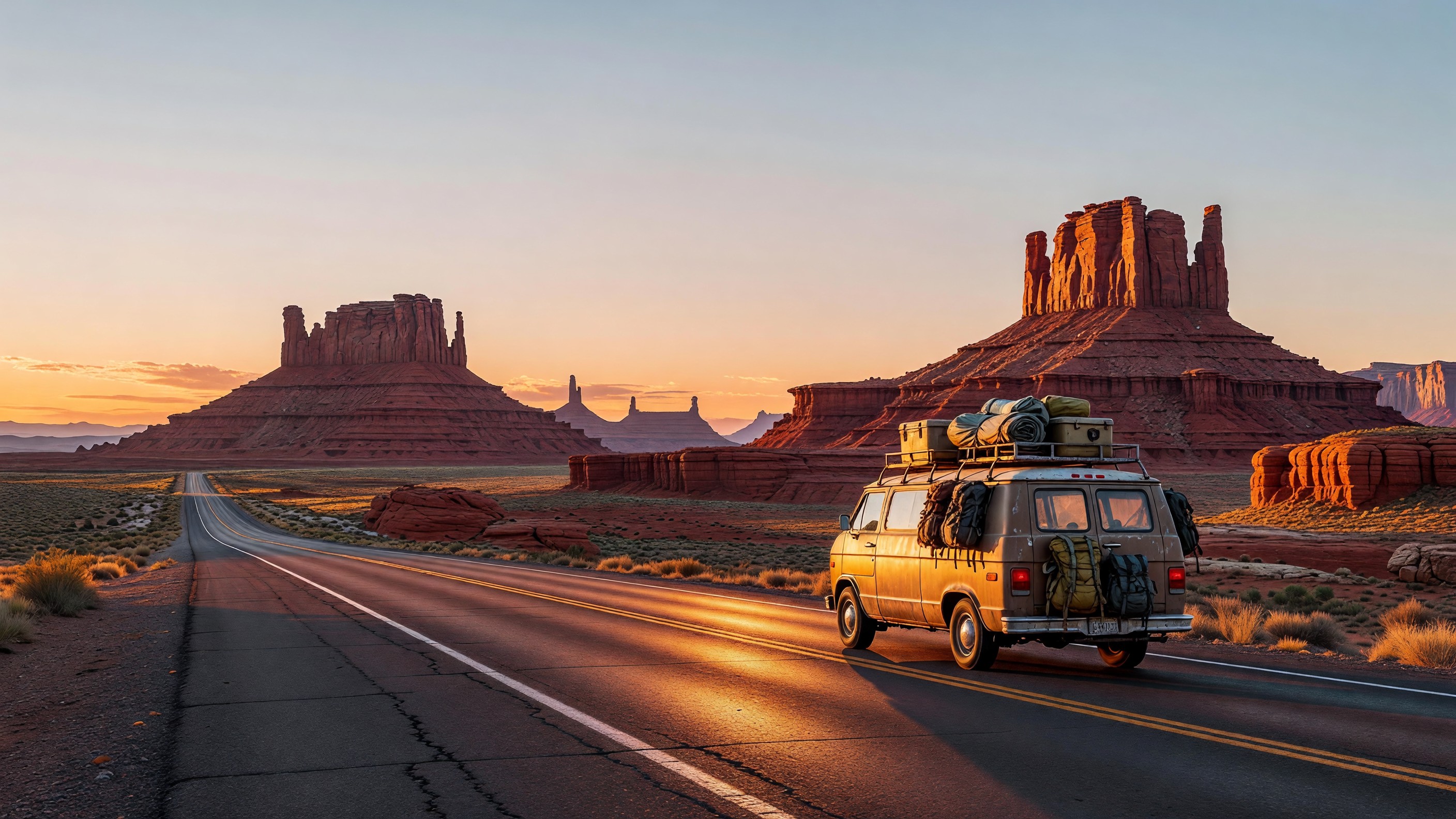
Day 9 — Monument Valley Navajo Tribal Park Monument Valley is operated by the Navajo Nation as a separate tribal park from NPS (admission fee, paid at the visitor center). The main viewpoint (from the visitor center deck looking at the Three Sisters, the Mittens, and Merrick Butte) is accessible without a guide. The Valley Drive (17-mile unpaved loop road) is doable in a standard sedan with careful tire management in dry conditions; high-clearance is preferred. Jeep tours operated by Navajo guides cover portions of the backcountry not accessible on the self-guided drive — the formations seen from the John Ford Point area are worth the guided detour. Lodging: The View Hotel (Navajo Nation owned, directly at the visitor center — rim-facing rooms have unobstructed Mittens views at sunrise; book months ahead) or Kayenta, AZ (22 miles south).
Drive to Mesa Verde: 165 miles / 2.5 hrs via US-163 North and US-160 East.
Days 10–11 — Mesa Verde National Park, Colorado Mesa Verde is the outlier in the Grand Circle geographically — it requires a detour into southwestern Colorado — but the Ancestral Puebloan cliff dwellings at Cliff Palace and Balcony House are unlike anything else on this route. Ranger-led tours for both sites require advance reservations via Recreation.gov (the tours fill quickly in summer). Far View Lodge (managed by Aramark) is the only in-park accommodation — on the mesa top with sweeping canyon views; book well ahead. Cortez, CO (9 miles west of the park entrance) has gateway hotels. Don’t skip the Chapin Mesa Archeological Museum — it contextualizes the cliff dwellings in ways the trailside signage cannot.
Return to starting point: Albuquerque is 350 miles / 5 hrs east via US-160 and I-25. Phoenix is 450 miles / 7 hrs south. Las Vegas is 475 miles / 7 hrs west.
Seasonal notes:
- Spring (April–May): Canyon rims are cool, not cold; Antelope Canyon light shafts start (photogenic); crowds building.
- Summer (June–August): Grand Canyon South Rim is hot (90–105°F at the rim, 110°F+ below); Monument Valley is extremely hot. Antelope Canyon tours book solid. Bryce and Mesa Verde at higher elevations are manageable.
- Fall (September–October): Best overall window. Canyon and desert temperatures reasonable; fall color at Mesa Verde’s cottonwoods. Grand Canyon Lodge availability opens up.
- Winter: Grand Canyon South Rim stays open and is excellent in snow/frost conditions. Bryce in snow is extraordinary. Antelope Canyon guided tours continue year-round. Monument Valley roads require caution in ice/snow.
Route 5: California Big 3
Parks: Yosemite → Sequoia / Kings Canyon → Death Valley Duration: 7–10 days Distance: 650–750 miles (San Francisco or Los Angeles base) Best base airports: San Francisco (SFO), Oakland (OAK), or Los Angeles (LAX) Pass math: $80 America the Beautiful covers Yosemite ($35/vehicle), Sequoia/Kings Canyon ($35), and Death Valley ($30). Total savings: $20 over single entries (break-even after two parks; Death Valley adds the remainder). Note: the pass covers the per-vehicle fee but not the $10–35 concessioner-reservation fees layered on top at Yosemite.
Important Yosemite note: Yosemite Valley has operated a day-use vehicle reservation system during peak hours in recent years. Check the current status at nps.gov/yose before your trip — reservation requirements, windows, and hours shift annually.
Stop-by-stop itinerary (San Francisco start):
Days 1–3 — Yosemite National Park (3.5 hrs from San Francisco via CA-120 / Big Oak Flat Road) In-park lodging managed by Aramark (operating as Yosemite Hospitality): The Ahwahnee (luxury historic hotel in the valley; book well in advance — 6–12 months for summer weekends), Yosemite Valley Lodge (standard hotel rooms near Yosemite Falls), Curry Village/Half Dome Village (canvas tent cabins and motel rooms). All valley lodging books quickly; Wawona Hotel (southern park district) and Tuolumne Meadows Lodge (high country, open only summer) are alternatives with different scenery. The Valley is the core experience — El Capitan meadows for sunrise light on the granite faces, Mirror Lake (seasonal) for Tenaya Canyon reflections, Valley View at Merced River for the full Yosemite Valley frame. Photography priority: Valley View and El Capitan Meadow at dawn (arrive before official sunrise). Tunnel View overlook (east portal of the Wawona Tunnel) at first light is the most reproduced Yosemite composition.
See the Yosemite National Park guide for full reservation and timed-entry details.
Drive to Sequoia / Kings Canyon: 180 miles / 3.5 hrs via CA-41 South and CA-180 East (entering through the Big Stump entrance to Kings Canyon, then south into Sequoia).
Days 4–5 — Sequoia and Kings Canyon National Parks Sequoia and Kings Canyon are jointly-administered NPS units sharing an entrance fee. The two parks share one pass — your America the Beautiful covers both. In-park lodging managed by Delaware North: Wuksachi Lodge (Sequoia — the primary in-park hotel, at 7,200 feet elevation, open year-round) and Grant Grove Cabins (Kings Canyon — historic cabins near the General Grant Tree). The Giant Forest Museum and General Sherman Tree loop (a 2-mile paved trail from the Wolverton parking area, or a shuttle from Lodgepole) are the core activities. General Sherman is the largest tree by volume on Earth at 52,508 cubic feet — the trail approach through the grove at golden hour has extraordinary light-to-bark-texture quality. The Kings Canyon Scenic Byway drops from Grant Grove into the Cedar Grove canyon along the Kings River — one of the deepest canyons in North America. Photography priority: General Sherman at dawn with side-lit bark texture, and Zumwalt Meadow in Cedar Grove for meadow-and-canyon compositions.
See the Sequoia National Park guide for seasonal road and trail conditions.
Drive to Death Valley: 290 miles / 5.5 hrs via CA-190 West (via Stovepipe Wells entrance).
Days 6–8 — Death Valley National Park Death Valley is the largest national park in the contiguous 48 states (3.4 million acres) and operates on a different logic from the rest of this route: the park is spring (February–April) and late fall / early winter (November–January) territory. Summer temperatures regularly exceed 120°F at the valley floor; visiting in June–September is inadvisable for most travelers. If your trip falls outside the ideal window, the Death Valley segment can be swapped for an earlier date.
In-park lodging managed by Xanterra and OAL Hotels: The Inn at Death Valley (luxury historic property, Furnace Creek — the flagship in-park experience), The Ranch at Death Valley (more casual rooms and RV sites). Stovepipe Wells Village Hotel (western park district) is the middle-ground option. Zabriskie Point at dawn is the photography pilgrimage — eroded badlands formations in the Amargosa Range glow amber and red at first light. Artist’s Palette is an afternoon drive (one-way Artist Drive, 9-mile loop accessible in any sedan — no height restrictions). Mesquite Flat Sand Dunes are accessible year-round; sunrise over the dunes is straightforward and excellent. The Death Valley visitor guide covers all named viewpoints by season.
Return to Los Angeles: 280 miles / 4.5 hrs via CA-127 South and I-15 South. Or to San Francisco: 500 miles / 8 hrs via US-395 North and I-580 West.
Seasonal notes:
- Spring (February–April): Death Valley wildflower bloom possible in wet years; ideal temperatures across all three parks.
- Summer (June–August): Death Valley should be avoided by most visitors; Yosemite and Sequoia are prime but crowded, require reservations.
- Fall (September–November): Sequoia and Kings Canyon are excellent in fall color (October); Death Valley cools by late October.
- Winter (December–January): Tioga Pass (CA-120 east entrance to Yosemite) closes with first snowfall, typically November; Valley remains accessible. Death Valley is its best self in winter.
Practical Road Trip Notes
Vehicle Considerations
All five routes are doable in a standard sedan for the primary itinerary. The nuances:
- Mighty 5 Utah: Paved corridors throughout for the main itinerary. Notom-Bullfrog Road (Capitol Reef) and Cathedral Valley Loop (Capitol Reef north) require high-clearance; avoid in wet conditions. Canyonlands’ Needles and Maze districts require high-clearance 4WD — those are side trips, not on the main route.
- Pacific Northwest Big 3: Paved throughout. SR-20 through North Cascades requires caution in early season (snowmelt rockfall) and closes in winter.
- Greater Yellowstone: Entirely paved. Internal Yellowstone roads are maintained and seasonally opened. No high-clearance needs for the main loop.
- Grand Circle Extended: Monument Valley’s Valley Drive is unpaved hardpack — passable in a sedan in dry conditions, but a crossover or truck is more comfortable. High-clearance for jeep-tour sections (those are guided; your vehicle stays at the lot).
- California Big 3: All paved. The Generals Highway in Sequoia has tight switchbacks with 22-foot vehicle length restrictions in certain segments — check nps.gov/seki for current size limits if driving an RV or tow vehicle.
America the Beautiful Pass — Buy It Before You Leave Home
The $80 annual interagency pass is available at any NPS fee station, at store.usgs.gov, or at recreation.gov. On any of these five routes, the pass pays for itself within the first two park entrances. On the Mighty 5, it saves approximately $70. On the Grand Circle, it saves $90 on NPS units alone (Antelope Canyon and Monument Valley require separate payment). One pass per vehicle; valid for 12 months from purchase date; covers the vehicle and all occupants at fee-charging NPS sites.
Free and reduced-fee versions: the Senior Pass ($80 lifetime, or $20 annual for US citizens or permanent residents 62+) is one of the most overlooked deals in outdoor recreation. Fourth-graders get a free pass through the Every Kid Outdoors program (available at everykidoutdoors.gov). Permanently disabled US citizens or residents qualify for a free Access Pass. Military members and their dependents receive free entry year-round.
Reservation Systems Active in 2024–2026
Several parks on these routes now operate advance reservation or timed-entry systems. Status changes year to year — always verify directly with the park before your trip:
| Park | System type | Where to check |
|---|---|---|
| Arches | Timed-entry pilot (active some years) | nps.gov/arch |
| Yosemite Valley | Day-use vehicle reservation (peak hours, some seasons) | nps.gov/yose |
| Zion (Angel’s Landing) | Day-hike permit lottery | recreation.gov |
| Mesa Verde (Cliff Palace, Balcony House) | Ranger-tour tickets required | recreation.gov |
| Glacier (Going-to-the-Sun Road) | Vehicle reservation (some years — verify) | nps.gov/glac |
| Antelope Canyon | Guided tour advance booking required | Licensed Navajo operators (Page, AZ) |
Food and Gas Planning
Utah: Gas stations are sparse between Capitol Reef and Moab (fill up in Torrey, UT before departing east). Moab has full grocery and fuel. Springdale (Zion gateway) has restaurants but limited grocery — stock up in St. George or Cedar City.
Pacific Northwest: Gas and food accessible throughout (US-2, US-101, SR-20 corridors have towns with services). The North Cascades Highway has a long stretch with no services between Marblemount and Winthrop in peak season; fill up and carry snacks.
Yellowstone / Grand Teton: Gas available at all major developed areas inside the parks (Mammoth, Canyon, Old Faithful, Fishing Bridge, Moose, Jackson Lake). Expect premium pricing — fill up in Gardiner, Jackson, or West Yellowstone when convenient.
Death Valley: Gas available at Furnace Creek Ranch and Stovepipe Wells, but at elevated prices. Fill in Baker, CA (I-15 corridor) or Lone Pine / Ridgecrest on the US-395 approach.
Leave No Trace + Carry-Out Trash
Every park on these routes operates under Leave No Trace principles. Practical field applications on road trips:
- Pack out all trash, including biodegradable food scraps (fruit peels, coffee grounds) — they attract ravens, ground squirrels, and bears to trailheads and parking areas.
- Use provided vault or flush toilets; where absent, follow cathole protocols (6–8 inches deep, 200 feet from water and trails).
- Stay on marked trails to protect biological soil crust — the dark, bumpy crust visible on Utah desert surfaces is a living organism that takes 50–250 years to recover from a single footprint.
- Wildlife distances: 100 yards minimum from bears and wolves; 25 yards from all other wildlife including bison, elk, and pronghorn. Bison goring incidents in Yellowstone are preventable — give them the right of way and don’t approach for photos.
- Camp only in designated sites or established dispersed sites at least 200 feet from water.
The Leave No Trace Center for Outdoor Ethics at lnt.org publishes the seven principles with specific regional guidance for desert, alpine, and coastal environments.
Frequently Asked Questions
How many days do I need for the Mighty 5 Utah loop?
Seven days is the minimum for a meaningful visit to all five parks — roughly 1.5 days per park. Ten days is more comfortable, especially if you want time for longer hikes (the Narrows at Zion, the full Navajo Loop at Bryce) and less rushing between parks. The scenic drive on UT-12 between Bryce and Capitol Reef alone warrants an extra half-day if the weather is clear.
Does the America the Beautiful pass cover Antelope Canyon and Monument Valley?
No. Antelope Canyon is on Navajo Nation land and operates through licensed private Navajo tour operators — the federal interagency pass does not apply. Monument Valley is a Navajo Tribal Park, also outside the NPS system. Both require separate admission and, in Antelope Canyon’s case, a mandatory guided tour reservation. Budget these separately from your park-pass planning.
What is the best time of year for an American West national park road trip?
Late April through early June and mid-September through late October are the two best overall windows. Both offer mild temperatures in desert and canyon parks, manageable crowds compared to peak summer, and better photography light (lower sun angle). Summer (July–August) is manageable at higher-elevation parks (Bryce, North Cascades, Rainier, Yellowstone) but genuinely hot and crowded at canyon-floor parks (Zion, Grand Canyon, Death Valley).
Is a 2WD sedan enough for these routes?
Yes for all main itinerary routes. The Mighty 5, Grand Circle, Pacific Northwest Big 3, Greater Yellowstone Loop, and California Big 3 are all paved road itineraries with no high-clearance requirements for the primary stop sequence. High-clearance becomes relevant only if you add unpaved detours: Notom-Bullfrog Road at Capitol Reef, Cathedral Valley Loop at Capitol Reef, or the Monument Valley Valley Drive in wet conditions. Don’t let AWD anxiety deter a standard sedan — these routes were designed for exactly that vehicle.
How do I handle the Yellowstone–Grand Teton combination in 5 days?
Five days is tight but doable: two days in Yellowstone’s north and central loops, one day in the Old Faithful/geyser basin area, and two days in Grand Teton. The trade-off is depth — you’ll see the marquee features but not the quieter corners. Hayden Valley wildlife watching and Lamar Valley (northeast Yellowstone, the best wolf-spotting corridor) can’t both be done justice in two days. If wildlife is a priority, add a day to Yellowstone. If photography and hiking are the priority, add it to Grand Teton.
What’s the difference between Sequoia and Kings Canyon, and do I need two days for both?
Sequoia and Kings Canyon are separate NPS units sharing one entrance fee and many visitor services, but they have distinct characters. Sequoia contains the Giant Forest — the massive sequoia groves including General Sherman — and is the more visitor-friendly park. Kings Canyon’s Cedar Grove area is a deep river canyon with far fewer services but spectacular scenery. Two days for both is the right minimum. You can do General Sherman + Grant Grove (Sequoia/Kings Canyon respectively) in a single long day, but the Kings Canyon Scenic Byway descent to Cedar Grove deserves its own morning.
Entrance fees, reservation systems, and concessioner booking links are verified as of 2024–2025 planning windows. Always confirm current requirements directly at nps.gov and recreation.gov before finalizing travel plans — timed-entry systems and reservation requirements change year to year at many western parks.
National Park Conservation Association (NPCA) at npca.org publishes annual park-by-park condition reports and advocacy updates useful for understanding policy changes affecting visitor access.