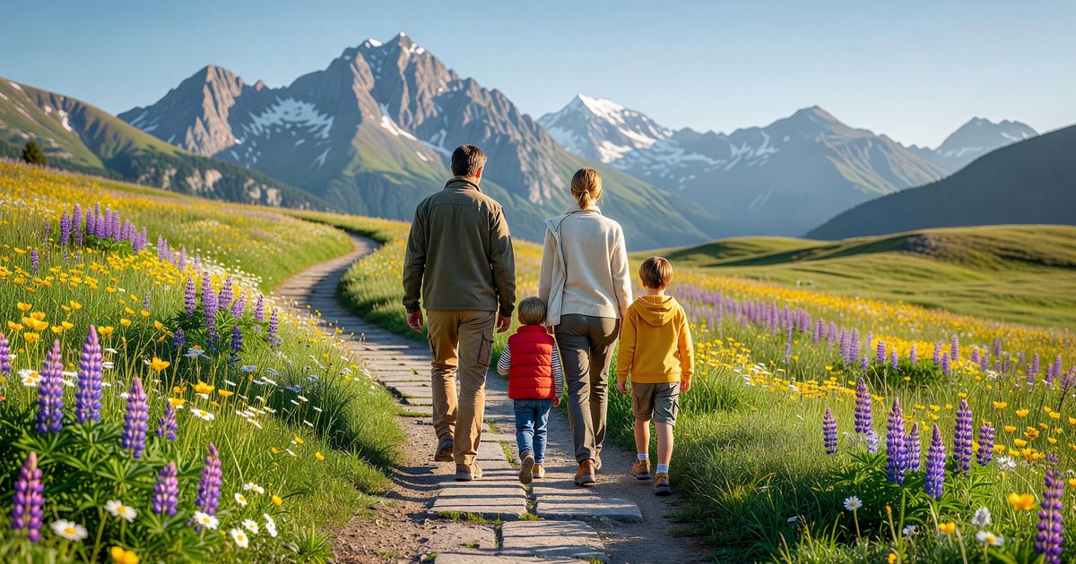
Most national park visitors spend fewer than four hours inside the park boundary. Studies by the NPS Social Science Program have consistently found that the majority of visitors stay on established trails, do not venture more than two miles from a trailhead, and never attempt overnight camping. The typical trip is a day visit: arrive mid-morning, walk a trail or two, eat lunch, drive through, leave by late afternoon.
That pattern is not a failure to appreciate the parks. It is a rational response to time constraints, fitness diversity, and the presence of children or older adults in the travel group. And in many of America’s most celebrated parks, a three-mile trail with 400 feet of elevation gain will take you somewhere so visually extraordinary that adding miles would not meaningfully improve the experience.
This list covers 18 hikes across 14 parks — all under five miles round-trip, most doable in under three hours, and several accessible to visitors with limited mobility or young children. Each entry includes total distance, elevation gain, terrain type, time estimate, what makes it worth doing, and notes on accessibility and family suitability.
One framing note: mileage alone is not the right way to assess a hike’s difficulty. A two-mile trail with 600 feet of elevation gain at 9,000 feet is harder than a four-mile trail on flat, paved ground at sea level. Elevation gain per mile, trail surface, altitude, and whether water is available mid-trail all matter more than the distance number. Use the details below — particularly the elevation gain figures and the terrain notes — to calibrate against your group’s actual fitness and experience.
Rocky Mountain and High-Alpine Hikes
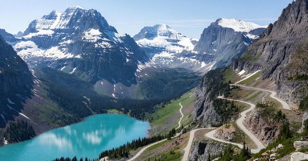
1. Hidden Lake Overlook — Glacier National Park, Montana
Distance: 2.7 miles round-trip | Elevation gain: 540 feet | Terrain: Boardwalk, then rocky trail; some uneven rock crossing near the overlook | Time estimate: 1.5–2.5 hours | Season: Mid-July through September (Logan Pass snowpack dependent — check nps.gov/glac for current conditions)
The trailhead sits at Logan Pass Visitor Center (6,646 feet), itself reached via the Going-to-the-Sun Road. The first mile follows a boardwalk through a high-alpine meadow that is, in peak season, one of the best subalpine wildflower displays in the American West. Mountain goats are a near-certainty near the pass — they favor the mineral lick just north of the parking area. The final 0.35 miles to the overlook involves rocky terrain and a modest scramble, but the payoff is Hidden Lake framed by Bearhat Mountain.
Family flag: Yes, with supervision near the rocky section at the end. The boardwalk stretch is excellent for young children. Accessibility: The boardwalk portion (approximately the first half-mile) is wheelchair-accessible from the Logan Pass Visitor Center.
NPS trail info: nps.gov/glac/planyourvisit/hidden-lake-trail.htm
2. Bear Lake to Emerald Lake — Rocky Mountain National Park, Colorado
Distance: 3.6 miles round-trip | Elevation gain: 605 feet | Terrain: Well-maintained rocky trail, some rocky steps | Time estimate: 2–3 hours | Altitude: Bear Lake trailhead at 9,475 feet — plan for altitude adjustment
Bear Lake is one of Rocky Mountain’s most-visited trailheads, and for good reason: the lake itself (a 0.6-mile loop from the parking area) is beautiful at minimal effort. The route to Nymph Lake (0.9 miles from Bear Lake trailhead), Dream Lake (1.6 miles), and finally Emerald Lake (1.8 miles) adds incremental distance for each payoff. Emerald Lake is the terminus and the best destination for the full 3.6-mile round-trip: a glacially-carved lake reflecting Hallett Peak and Flattop Mountain.
Timed entry permits are required for the Bear Lake Road Corridor during peak summer hours — check current-year status and booking windows at recreation.gov and nps.gov/romo. The shuttle system from the Glacier Basin Transit Center eliminates parking stress and is strongly recommended.
Family flag: Yes — the trail to Dream Lake is well within range for most school-age children. Accessibility: The Bear Lake Loop is paved and accessible; the trail beyond Bear Lake is rocky and not accessible.
3. Glacier Vista — Mount Rainier National Park, Washington
Distance: 2.0 miles round-trip | Elevation gain: 500 feet | Terrain: Well-maintained subalpine trail, some rocky sections | Time estimate: 1.5–2 hours | Season: Mid-July through September
The Paradise area of Mount Rainier — the visitor center sits at 5,400 feet — anchors the park’s most popular summer hiking. The Skyline Trail loop runs 5.5 miles total, but breaking off at the Glacier Vista spur (approximately 1.0 miles from the visitor center, 500 feet up) gives you a direct view of the Nisqually Glacier and the Carbon-Emmons-Winthrop Glacier complex without the full loop’s distance. On clear days — not a given at Rainier — the view extends to the summit icefield.
Family flag: Yes for school-age children comfortable with some elevation. Accessibility: The paved walkways around Paradise Visitor Center are accessible; the trail to Glacier Vista is not.
NPS trail info: nps.gov/mora/planyourvisit/trails-and-backcountry-information.htm
4. Sunrise Nature Trail — Mount Rainier National Park, Washington
Distance: 1.5 miles round-trip (loop) | Elevation gain: 150 feet | Terrain: Hardened subalpine trail | Time estimate: 45 minutes–1.5 hours | Season: Mid-July through September; Sunrise Road opens late
The Sunrise Visitor Center (6,400 feet — the highest point reachable by car in the park) anchors this loop through open subalpine meadows with direct views of Little Tahoma Peak and Mount Rainier’s eastern ice fields. The elevation is genuine — 6,400 feet affects people differently — but the trail itself is short and well-maintained.
Family flag: Excellent — this is the best short walk for families at Sunrise. Accessibility: Partially accessible; the eastern section near the visitor center is accessible, the meadow loop is not paved.
Desert Southwest Hikes
5. Navajo Loop and Queen’s Garden — Bryce Canyon National Park, Utah
Distance: 2.9 miles round-trip (combined loop) | Elevation gain: 521 feet descent and re-ascent (you start at the rim and drop in) | Terrain: Packed dirt and switchbacks, narrow in sections, moderate ankle demand | Time estimate: 2–3 hours
The Bryce Canyon hoodoos are best experienced from inside the amphitheater, not from the rim — and this loop is the most efficient way to achieve that. The Navajo Loop descends via steep switchbacks into the canyon floor (Wall Street section passes between hoodoos close enough to touch), intersects with Queen’s Garden (the gentler ascent return), and loops back up to Sunrise Point. This is not technically demanding, but the descent and re-ascent require steady footing on uneven, sandy packed-dirt surfaces.
The Bryce Canyon Shuttle (free, timed-entry to rim viewpoints required during summer) serves both Sunrise and Sunset Points — plan accordingly. Verify current timed-entry requirements at nps.gov/brca.
Family flag: Yes for children 7 and older who are comfortable with steep switchbacks. Not appropriate for strollers. Accessibility: Rim trail between viewpoints is partially accessible; the loop itself is not.
6. Window Arches Loop — Arches National Park, Utah
Distance: 1.0 mile round-trip (loop) | Elevation gain: 83 feet | Terrain: Sandy packed dirt, flat | Time estimate: 30–45 minutes
The Windows section of Arches contains two of the park’s largest arches — North Window (51 feet tall, 93 feet wide) and South Window (66 feet tall, 105 feet wide) — reachable via a one-mile loop that most visitors complete in under an hour. The scale of the arches is difficult to appreciate in photographs; standing below them resets expectations.
Note: Arches operates a timed-entry reservation system during peak hours (typically April–October). Reservations are available at recreation.gov — check current-year details at nps.gov/arch before visiting.
Family flag: Excellent — one of the best short hikes in any national park for families with young children. Accessibility: The base of the arches is reachable via a short primitive spur that is not paved but is relatively flat.
7. Delicate Arch Viewpoints — Arches National Park, Utah
Distance (lower viewpoint): 0.5 miles round-trip, flat, paved | Distance (upper viewpoint): 0.5 miles round-trip, 100-foot elevation gain, accessible trail | Time estimate: 20–30 minutes each
The Delicate Arch viewpoints offer a view of the park’s most iconic arch without the demands of the full Delicate Arch Trail (3.2 miles round-trip, 480-foot gain, exposed slickrock). The lower viewpoint is fully accessible via paved path. The upper viewpoint, a short climb above, provides a slightly elevated angle.
Note: The viewpoints are cross-canyon — Delicate Arch appears at a distance across the canyon floor. The scale and framing are different from the full trail experience, which approaches the arch from below. Both experiences are worthwhile; they are not interchangeable.
Family flag: Excellent. Accessibility: Lower viewpoint is fully accessible (paved, flat).
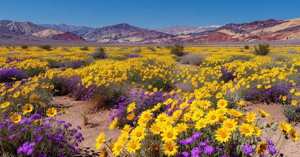
8. Mesquite Flat Sand Dunes — Death Valley National Park, California
Distance: 1.0–2.0 miles (variable — no formal trail) | Elevation gain: Minimal | Terrain: Open sand dunes | Time estimate: 1–2 hours | Season: October through April — dangerous in summer heat
The Mesquite Flat Dunes, situated at 0 feet elevation just north of Stovepipe Wells, are the most accessible dune field in Death Valley. There is no formal trail — visitors walk onto the dunes and return the same way. The sense of scale relative to the surrounding mountain ranges is genuinely disorienting in the best sense.
Timing note: Death Valley is a summer-avoidance park. Temperatures exceed 120°F in July and August. The dunes are best visited October through April; even in spring and fall, morning hours are strongly preferred over midday. Carry far more water than you expect to need — a minimum of one liter per person per hour in any warm weather. See the Death Valley Visitor Guide for seasonal timing details.
Family flag: Yes, in cool-season months. Accessibility: The parking area is paved; the dune surface is soft sand, not accessible for mobility devices.
Pacific Northwest and West Coast Hikes
9. Marymere Falls — Olympic National Park, Washington
Distance: 1.8 miles round-trip | Elevation gain: 200 feet | Terrain: Well-maintained forest path, some root sections near the falls | Time estimate: 1–1.5 hours
The Barnes Creek trailhead near Lake Crescent leads through one of the best old-growth forest sections accessible on a short walk in Olympic National Park — massive Douglas-firs and Sitka spruce, dense fern understory, deep shade. Marymere Falls itself drops 90 feet over a basalt shelf. The approach through the forest is arguably as good as the falls viewpoint.
Family flag: Excellent — one of the most consistently recommended family hikes in the Pacific Northwest. Accessibility: The first portion of the trail (near Lake Crescent Lodge) is accessible; the section approaching the falls is not.
NPS trail info: nps.gov/olym/planyourvisit/marymerefalls.htm
10. Lower Yosemite Falls — Yosemite National Park, California
Distance: 1.0 mile (loop) | Elevation gain: 50 feet | Terrain: Paved loop, some rocky sections near the falls base | Time estimate: 30–45 minutes
Yosemite Falls — at 2,425 feet total drop, one of the tallest waterfalls in North America — is accessed at its base via this paved loop from the Yosemite Valley shuttle stop. Peak flow is April through June when snowmelt is highest; by late summer the falls often run dry. The view from the lower falls pool looking up the full 2,425-foot drop is one of the most striking perspectives in the Valley.
Yosemite Valley requires advance reservations during peak season. Verify current entry reservation and parking requirements at nps.gov/yose.
Family flag: Excellent. Accessibility: The paved loop is accessible from the shuttle stop; the rocky section at the falls base is not paved but is relatively flat.
11. Mist Trail to Vernal Fall Bridge — Yosemite National Park, California
Distance: 1.6 miles round-trip | Elevation gain: 400 feet | Terrain: Paved granite steps and well-maintained trail; wet/slippery near the bridge in spring and early summer | Time estimate: 1–1.5 hours
The Mist Trail is Yosemite Valley’s most popular hiking trail, and the Vernal Fall Bridge at 1.0 miles is the natural turning point for a short version. The view from the bridge — looking directly at the 317-foot Vernal Fall with the Merced River below — is one of the Valley’s classic perspectives. In peak flow season (April–June), mist from the falls reaches the trail and the bridge; waterproof layers are useful, and the granite steps are genuinely slippery.
The full trail continues to the top of Vernal Fall (2.4 miles RT, 1,000 feet gain) and Nevada Fall (5.4 miles RT) — but the bridge is a legitimate, satisfying turnaround.
Family flag: Yes for the bridge, with caution on wet granite — appropriate footwear matters. Accessibility: Not accessible; significant elevation gain on stone steps.
Mountain and Appalachian Hikes
12. Andrews Bald — Great Smoky Mountains National Park, North Carolina/Tennessee
Distance: 3.6 miles round-trip | Elevation gain: approximately 600 feet cumulative (net descent from trailhead to bald — the Forney Ridge parking area sits at ~6,313 ft, Andrews Bald at 5,920 ft, with undulating terrain both ways) | Terrain: Well-maintained but rooted trail, some rocky sections; the bald itself is open grass | Time estimate: 2.5–3.5 hours | Season: Year-round (snow and ice in winter)
Andrews Bald is one of two natural grass balds in Great Smoky Mountains accessible via maintained trail (Clingmans Dome Road trailhead at 6,311 feet), and the views from the open bald — across the Southern Appalachian ridgeline — are unobstructed and different in character from any other viewpoint in the park. The elevation gain is the most demanding on this list at 1,000 feet for a sub-5-mile hike; it is a genuine workout for young children.
Family flag: Better for families with older children (8+) who can handle sustained elevation gain. Not appropriate for strollers. Accessibility: Not accessible.
NPS trail info: nps.gov/grsm/planyourvisit/andrews-bald.htm
13. Brandywine Falls and Gorge Trail — Cuyahoga Valley National Park, Ohio
Distance: 1.4 miles round-trip | Elevation gain: 180 feet | Terrain: Paved boardwalk to falls overlook; optional unpaved gorge trail extension | Time estimate: 45 minutes–1.5 hours
Brandywine Falls, at 65 feet, is the signature natural feature of Cuyahoga Valley — a stepped waterfall over shale and sandstone surrounded by hemlock and hardwood forest. The boardwalk from the upper parking area to the main overlook is accessible. The optional gorge trail extension (additional 0.5 miles one-way) follows the gorge floor and is unpaved.
Cuyahoga Valley is a significantly undervisited national park for its proximity to Cleveland and Akron — and Brandywine Falls is the park’s single most reliable short-hike payoff. For more on the park’s full visitor offering, see the Cuyahoga Valley visitor guide.
Family flag: Excellent. Accessibility: The boardwalk to the upper overlook is accessible; the gorge extension is not.
NPS trail info: nps.gov/cuva/planyourvisit/brandywine-falls.htm
Grand Teton Hikes
14. Jenny Lake Hidden Falls and Inspiration Point — Grand Teton National Park, Wyoming
Distance: 1.0 miles round-trip (with shuttle boat) to Hidden Falls; 2.0 miles RT to Inspiration Point | Elevation gain: 200 feet to Hidden Falls, 420 feet to Inspiration Point | Terrain: Well-maintained rocky trail | Time estimate: 1–2 hours (with boat) | Season: Mid-May through mid-September (boat dependent)
The Jenny Lake Shuttle Boat (a fee-based service, not NPS-operated) crosses the lake in 10 minutes and deposits hikers at the west dock, 0.5 miles from Hidden Falls. Without the boat, Hidden Falls is 2.5 miles from the east dock (and 5.0 miles RT to Inspiration Point) — outside this list’s five-mile threshold from that starting point. The boat makes both destinations practical for shorter-hike visitors.
Inspiration Point, 0.5 miles above Hidden Falls via rocky switchbacks, gives the best above-tree-level view of Jenny Lake and the full Teton Range. The view at Inspiration Point is widely considered one of the finest short-hike panoramas in any national park.
The shuttle boat schedule and fares are managed by the park’s authorized concessionaire — check current-year details at nps.gov/grte.
Family flag: Yes for school-age children — the boat ride adds to the appeal for kids. Accessibility: Not accessible beyond the east dock visitor area.
Canyon Country and Colorado Plateau
15. Grand Prismatic Spring Overlook — Yellowstone National Park, Wyoming
Distance: 2.5 miles round-trip (from Fairy Falls Trailhead) | Elevation gain: 50 feet to the overlook spur | Terrain: Flat gravel trail to overlook spur; elevated boardwalk section at the overlook | Time estimate: 1–1.5 hours
Grand Prismatic Spring — the largest hot spring in the United States and the third largest in the world — is best understood from above. The overlook on the Fairy Falls Trail, reached via a short spur 1.0 miles from the Midway Geyser Basin Trailhead (or 1.25 miles from the Fairy Falls Trailhead), gives the aerial perspective needed to see the full color gradient: deep blue center, ringed by green, yellow, orange, and brick-red bands created by heat-adapted microbial mats.
The boardwalk-level view at the Midway Geyser Basin (a separate, accessible route) gives a different and equally worthwhile close-range perspective but misses the full aerial color pattern.
Family flag: Excellent — the overlook view is genuinely spectacular for all ages. Accessibility: The Fairy Falls Trail is wide and flat; the overlook spur involves some unpaved rocky surface. The Midway Geyser Basin boardwalk loop (0.7 miles) is fully accessible.
NPS info: nps.gov/yell/planyourvisit/fairyfalls.htm
Hawaii and Volcanic Parks
16. Devastation Trail — Hawaii Volcanoes National Park, Hawaii (Big Island)
Distance: 1.0 mile one-way (2.0 miles RT, or one-way with shuttle) | Elevation gain: Minimal | Terrain: Paved | Time estimate: 30–45 minutes
The Devastation Trail crosses the terrain swept by the 1959 Kilauea Iki eruption — a cinder field with ghost-bleached ‘ohi’a trees, some dead, some remarkably resilient, rising from black volcanic rock. The landscape is eerie, scientifically interesting, and unlike anything accessible on a paved trail elsewhere in the National Park System. A one-way shuttle option is available at peak season; check current trail status at nps.gov/havo (volcanic activity occasionally affects access).
Family flag: Excellent. Accessibility: Fully accessible — paved throughout.
Accessible Trails and Flat Terrain
17. Pa’rus Trail — Zion National Park, Utah
Distance: 3.5 miles one-way (7.0 miles round-trip, or as a one-way shuttle segment) | Elevation gain: 50 feet | Terrain: Paved, shared-use trail | Time estimate: 1.5–2.5 hours one-way
The Pa’rus Trail follows the Virgin River from the South Campground to the Canyon Junction, crossing the river twice via bridges. It is the only trail in Zion open to dogs and bicycles, runs entirely on paved surface, and is accessible for wheelchairs and strollers. In a canyon park where most other trails involve steep switchbacks or river wading, Pa’rus is the primary option for visitors with mobility considerations.
It also happens to be genuinely beautiful — the canyon walls are visible from the river level, and early morning and late afternoon light on the sandstone is exceptional. Pair with the Zion Canyon Shuttle for a one-way walk back to the visitor center.
Family flag: Excellent — among the best stroller-friendly hikes in the Southwest. Accessibility: Fully accessible.
NPS info: nps.gov/zion/planyourvisit/parus-trail.htm
18. Mist Trail to Vernal Fall Bridge — see entry 11 above. (For a second fully accessible Yosemite option, the Lower Yosemite Falls loop at entry 10 is the correct choice.)
How to Choose Among Short Trails: Five Planning Variables
Elevation gain matters more than distance
A 2.7-mile trail with 540 feet of gain (Hidden Lake Overlook) is meaningfully harder than a 3.5-mile paved trail with 50 feet of gain (Pa’rus Trail). When assessing whether a trail is appropriate for your group, convert elevation gain into a rough per-mile figure: 200 feet per mile is moderate, 400+ feet per mile is challenging, 600+ feet per mile is strenuous. Apply this before you look at the total mileage.
Altitude is an invisible multiplier
A trail that would feel easy at sea level becomes noticeably harder at 9,500 feet (Bear Lake to Emerald Lake) or 6,400 feet (Sunrise Nature Trail). First-day high-altitude hiking is strongly discouraged for groups with young children, older adults, or anyone with cardiac or respiratory conditions. A rest day at elevation — or arriving a day early and staying local — makes a meaningful difference. The CDC recommends acclimatizing at least 24 hours before significant physical activity above 8,000 feet.
Water requirements
Short hikes have a deceptive water profile. A 1.5-hour hike in Death Valley in April at 85°F requires more water than a 3-hour hike in Olympic’s 60°F forest. As a baseline: carry one liter per person per hour in warm, dry, or high-elevation conditions; 500ml per person per hour in cool, shaded, or sea-level conditions. Most of the trails on this list lack mid-trail water sources — carry everything you need from the trailhead.
Weather and season constraints
Half the trails on this list are summer-only propositions due to snow. Logan Pass (Hidden Lake Overlook) typically opens in mid-July; Paradise and Sunrise at Mount Rainier similarly. Timing a visit in June expecting alpine access is a common planning error — verify trail status at the relevant NPS site before travel, not before booking.
Junior Ranger program integration
The NPS Junior Ranger program is available at all parks on this list. Most parks issue park-specific activity booklets (available at the visitor center), with badge or certificate completion requiring visits to specific sites, a ranger interaction, and some reflection activities. The trails on this list that most naturally integrate with Junior Ranger requirements are: Marymere Falls (Olympic, excellent ranger-to-visitor ratio at Lake Crescent), Andrews Bald (Great Smoky, rangers at Clingmans Dome), and Hidden Lake Overlook (Glacier, Logan Pass Visitor Center is staffed). Ask at the visitor center on arrival — ranger recommendations often reveal the best trail for your group’s age range.
Frequently Asked Questions
What is the easiest national park hike for young children?
The Lower Yosemite Falls loop (1.0 mile, paved, 50-foot gain) and the Window Arches Loop in Arches (1.0 mile, flat, sandy surface) are consistently cited as the best options for young children. Pa’rus Trail in Zion (3.5 miles, paved, accessible, dog-friendly) is the best option for families with strollers or very young children. For families wanting a bigger payoff in less time, the Jenny Lake Boat Shuttle to Hidden Falls in Grand Teton delivers an iconic view on less than one mile of walking.
Are there wheelchair-accessible trails in national parks?
Yes — several of the trails on this list have accessible sections. Fully accessible options include: Devastation Trail in Hawaii Volcanoes (1.0 mile, paved), Pa’rus Trail in Zion (3.5 miles, paved), and the Lower Yosemite Falls loop (1.0 mile, paved). Partially accessible options include: Hidden Lake Overlook boardwalk section in Glacier, Midway Geyser Basin boardwalk at Yellowstone, and Brandywine Falls boardwalk in Cuyahoga Valley. Always verify current accessibility status at the park’s official NPS page before visiting — conditions and surfacing change seasonally.
What is the best short hike in Glacier National Park?
Hidden Lake Overlook (2.7 miles round-trip, 540 feet gain) from Logan Pass is the most consistently recommended short hike at Glacier for visitors who want the classic high-alpine experience. The boardwalk through the wildflower meadow and the mountain goat sightings near the pass make the first mile exceptional even if weather prevents reaching the overlook. Verify Logan Pass road access at nps.gov/glac — Going-to-the-Sun Road has a vehicle reservation requirement during peak summer windows.
How do I pick a trail if my group has mixed fitness levels?
Use the trail with the lowest elevation gain per mile, not the shortest total distance. For a group with young children or limited fitness, prioritize: paved surface, under 300 feet of total gain, and a clear turnaround point with a payoff (waterfall, lake, arch) before the halfway mark. On this list: Lower Yosemite Falls, Window Arches Loop, Devastation Trail, Brandywine Falls boardwalk, and Pa’rus Trail all fit that profile. If altitude is a factor, stick to sea-level or low-elevation parks (Olympic, Cuyahoga Valley, Hawaii Volcanoes, Zion’s Pa’rus Trail).
Do short national park hikes still require reservations?
Several parks with short hikes on this list have timed-entry systems during peak season. Arches requires a timed-entry vehicle reservation (April–October peak window). Rocky Mountain’s Bear Lake Road Corridor requires a park entry reservation during peak hours. Yosemite Valley has had varying reservation requirements by year — verify at nps.gov/yose before your visit. The reservation is almost always for vehicle entry to the park or the specific parking area, not for the trail itself.
Can you do multiple short hikes in one national park day?
Yes — several parks on this list support a two-hike day at short distances. At Arches, the Window Arches Loop (1.0 mile) and the Delicate Arch Lower Viewpoint (0.5 mile) are both easily combined with a third stop at Balanced Rock (0.3-mile loop). At Yosemite Valley, Lower Yosemite Falls (1.0 mile) and Mist Trail to Vernal Fall Bridge (1.6 miles) are within shuttle range of each other. At Mount Rainier, the Sunrise Nature Trail (1.5 miles) and a drive to Paradise for a short walk add up to a full park day without exceeding three total trail miles.
Short hikes are not a consolation prize. Some of the most visually powerful places in the National Park System are accessible on under two miles of maintained trail. The skill is matching the trail to the group — reading elevation gain carefully, checking for seasonal closures before travel, and bringing more water than seems necessary. The parks themselves take care of the rest.
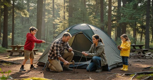
For families planning a first national park trip, the family summer camping guide covers campground options, booking windows, and Junior Ranger logistics across the same parks that anchor this list. For the Badlands, Death Valley, and Great Smoky Mountains trail options covered briefly here, each park’s full directory profile goes deeper on driving loops, campground access, and multi-day options.